
Over the next few days we will be featuring this first hand account of hiking the Drakensberg Grand Traverse, breaking it up into its daily instalments and posting them periodically. This hike was done in October 2014 but the report for the most part remains relevant with regard to shining some light on what an undertaking of this nature entails.
Words by Robert Lorriman, and pictures by Pall Catt.
On the Saturday prior to starting, I ran the Park run in Delta Park. I was a little tired from the excesses of the night before and consequently twisted my ankle on a flat, easy section where I concentrated less on the running surface and more on the hill that I was pushing up. I continued running but the next day things were fairly swollen. I sought advice from my brother. Hugh-Guy had mentioned in his post-Lakeland 100 write up that he had met a runner who had run with a twisted ankle. Apparently, I was unlikely to do any permanent damage. I resolved to take ibuprofen throughout the walk to control the swelling and pain and recommended that Pall do the same, despite no injuries having yet befallen him, such was the anticipated severity of the task ahead.
An executive summary of the task:
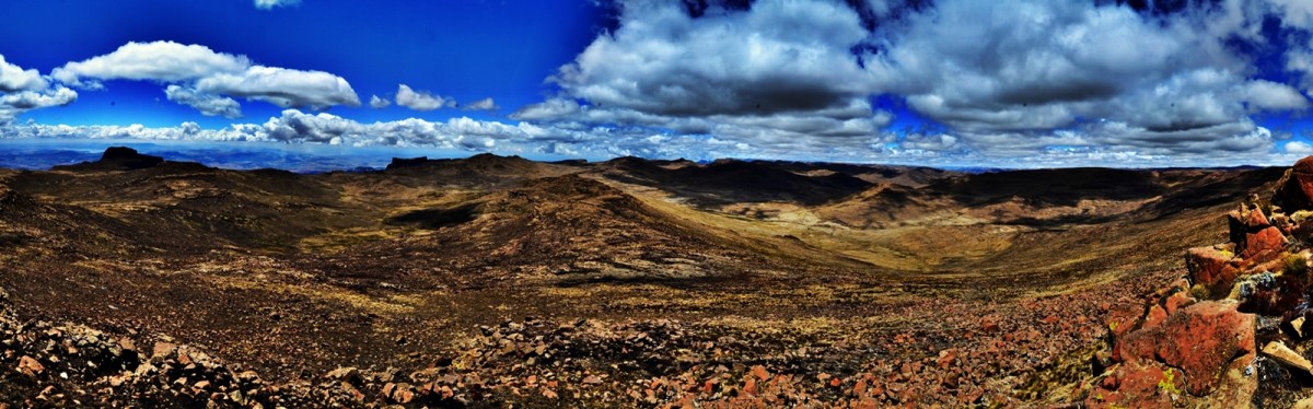
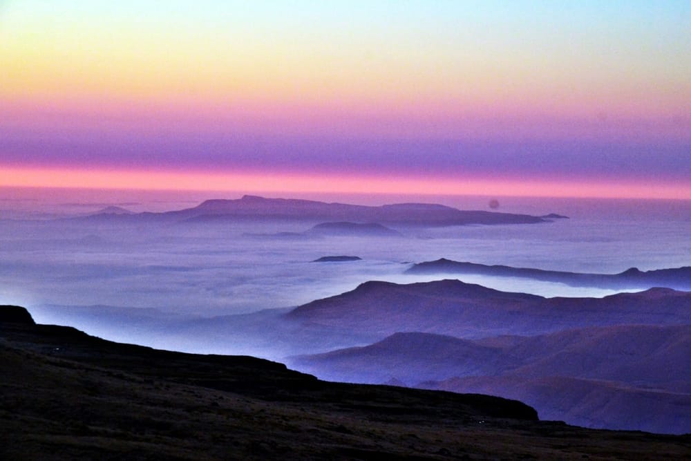
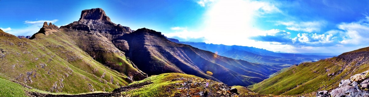
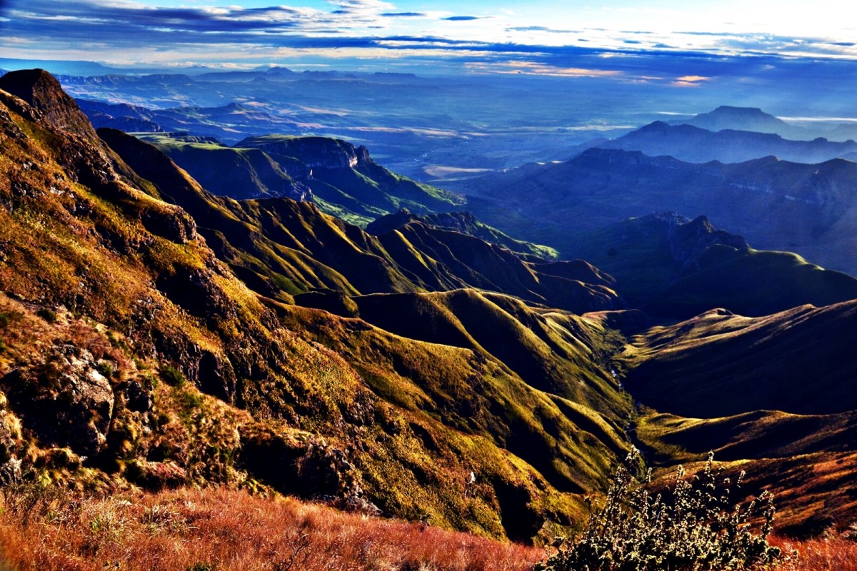
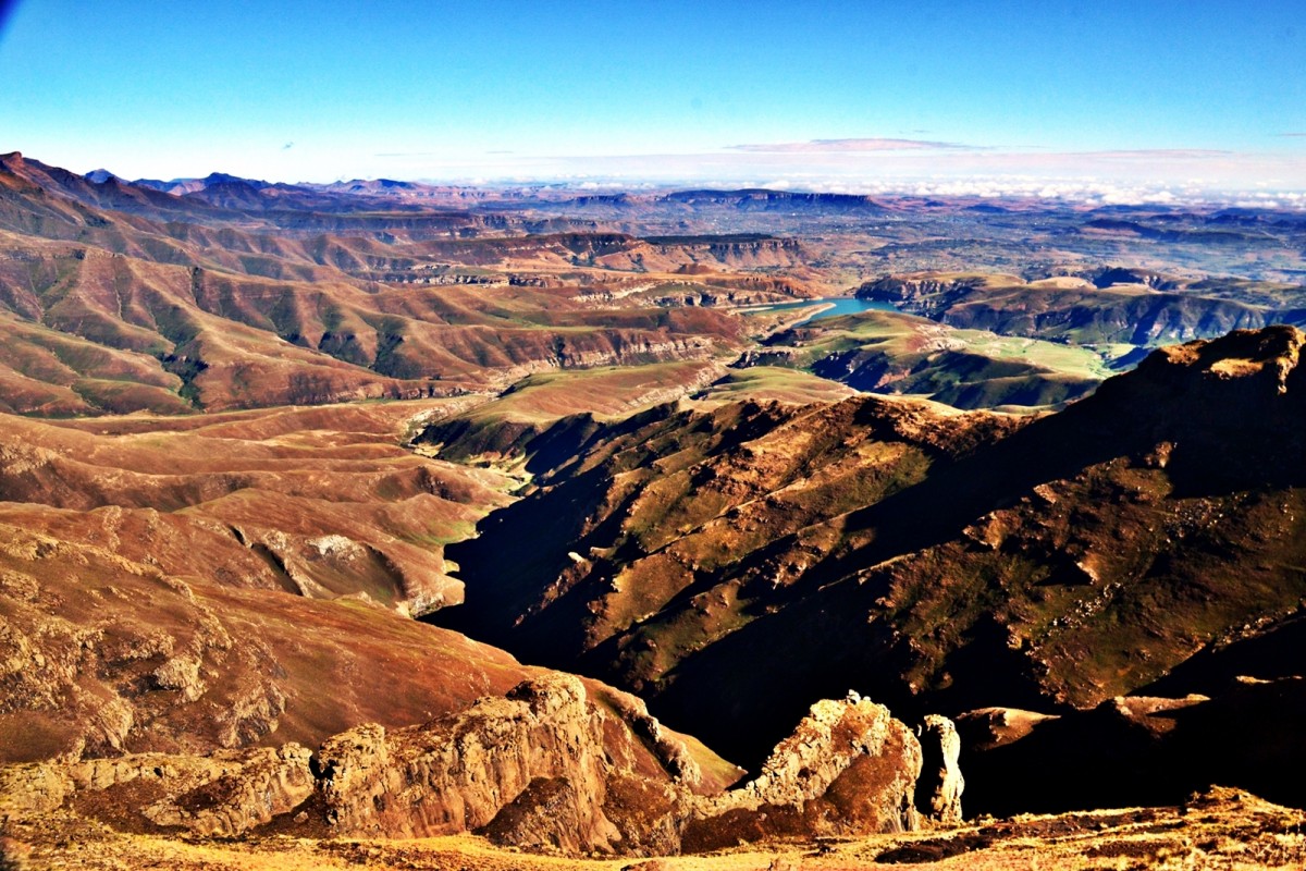
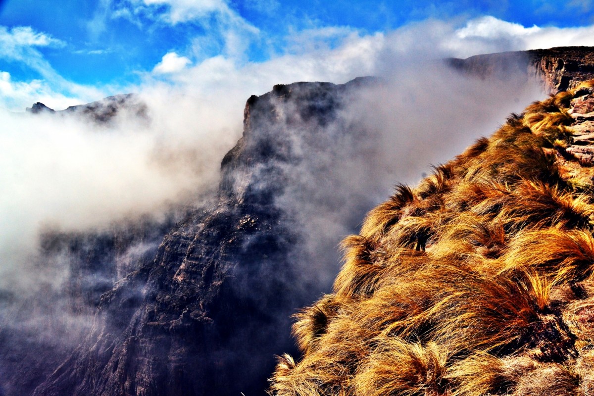
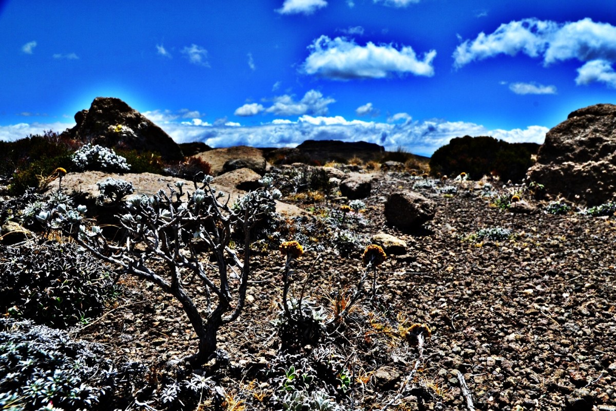
A 200km walk in the Drakensberg Mountains. Bouncing against the South African border with Lesotho marked by the great escarpment where the heights of Lesotho fall 2000m to the rolling pastures of KwaZulu-Natal. Each great bounce taking us via long valleys into the territory of the Basotho shepherds and herd boys. An extraordinarily simple way of life with simple single roomed stone dwellings topped with straw. No utilities but the flowing mountain streams. Young shepherds dressed in underpants, blankets and patched up wellington boots topped off with a sock like hat usually worn curved forward like an Aztec. This was walking into an all different world where life was as unsophisticated as it had ever been…
16 October – Thursday – The day before
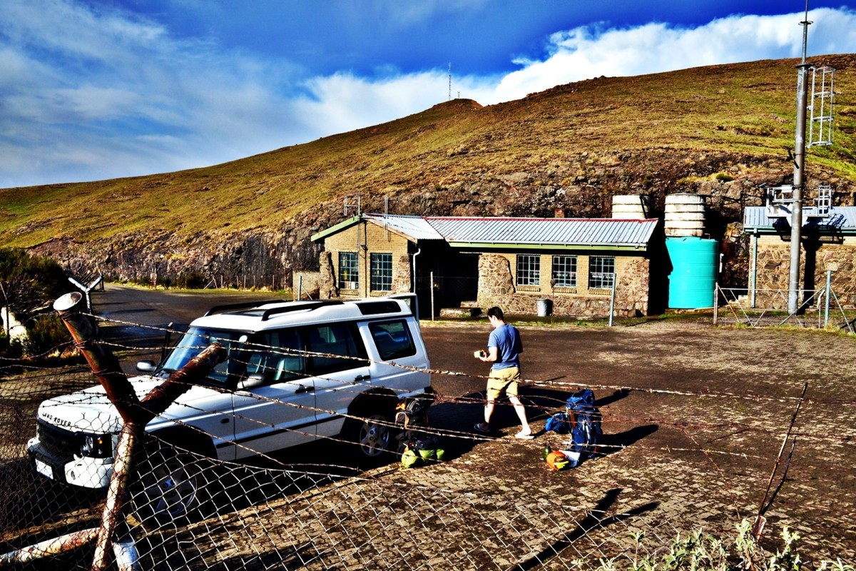
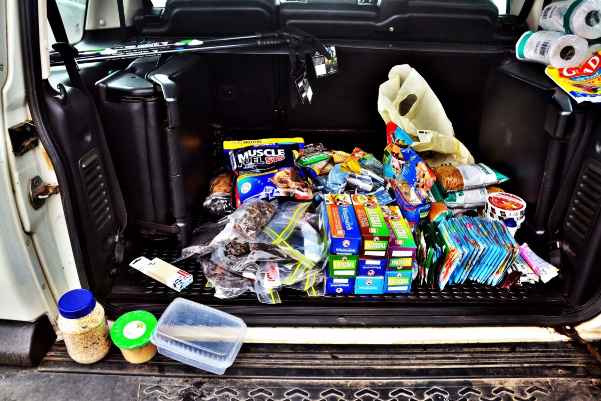
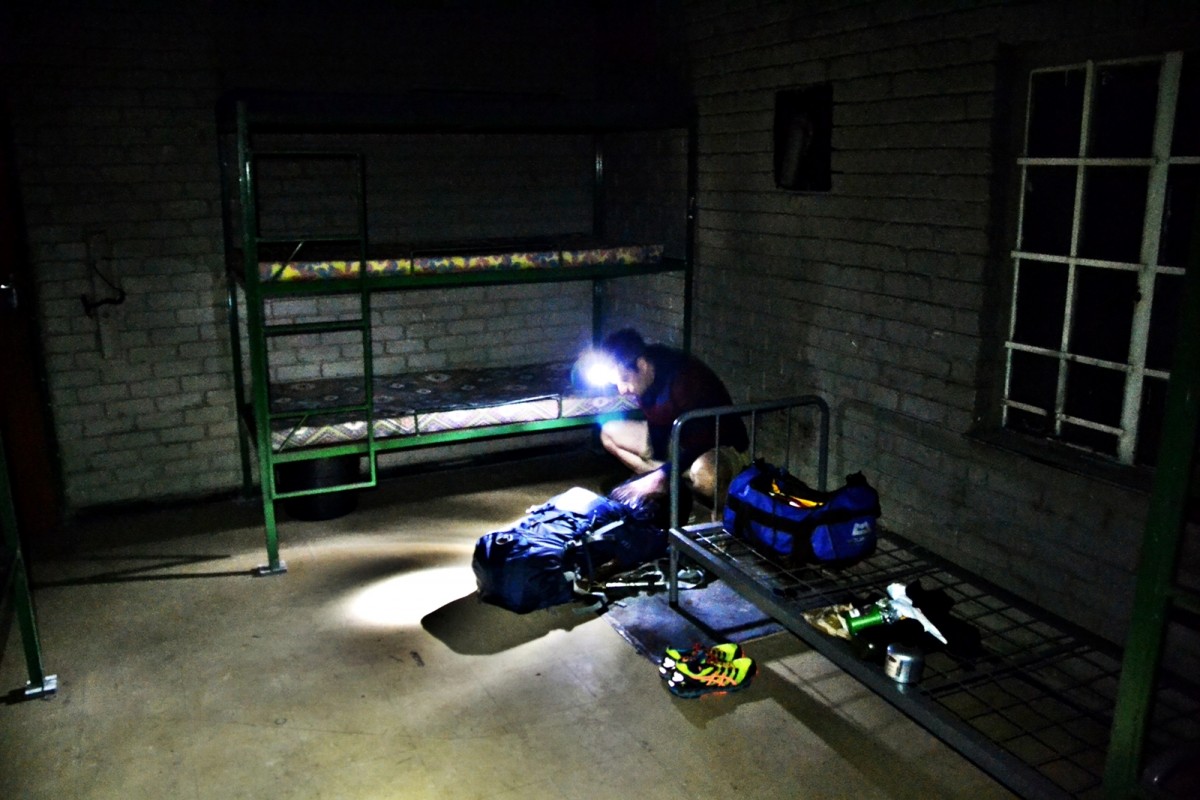
We drove straight from Johannesburg to the Sentinel car park. It is open 24hrs, but we wanted to sort out some final arrangements and get a little rest in the hikers huts there before the planned sunrise departure. The plan was to leave the car there. Pall had forgotten to bring a toothbrush so we went to the Witsieshoek Mountain Lodge, a mere 8km down the road, to attempt to source one. There we met lodge managers John & Barbara. John kindly offered to bring our car down from the Sentinel car park to be kept at Witsieshoek for safe keeping after we had departed on foot and then offered to pick us up in our car from Bushmansnek or anywhere else along the route preferably on a Monday. With the final arrangements made and our backpacks repacked with 14 days worth of provisions, we crawled into our sleeping bags in the hikers hut and dreamed about the landscapes that lay ahead of us.
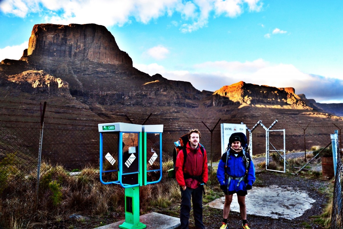
17 October – Friday – Day one
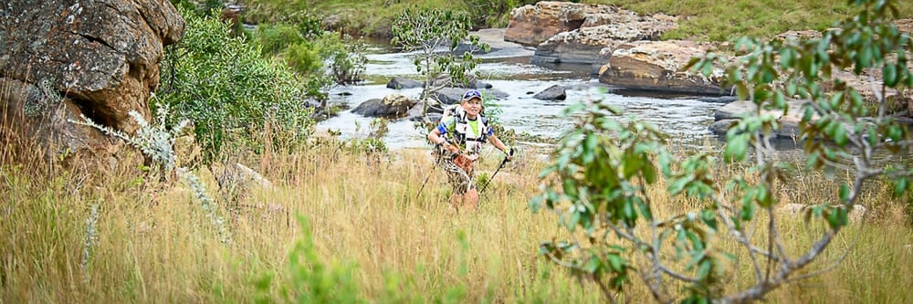
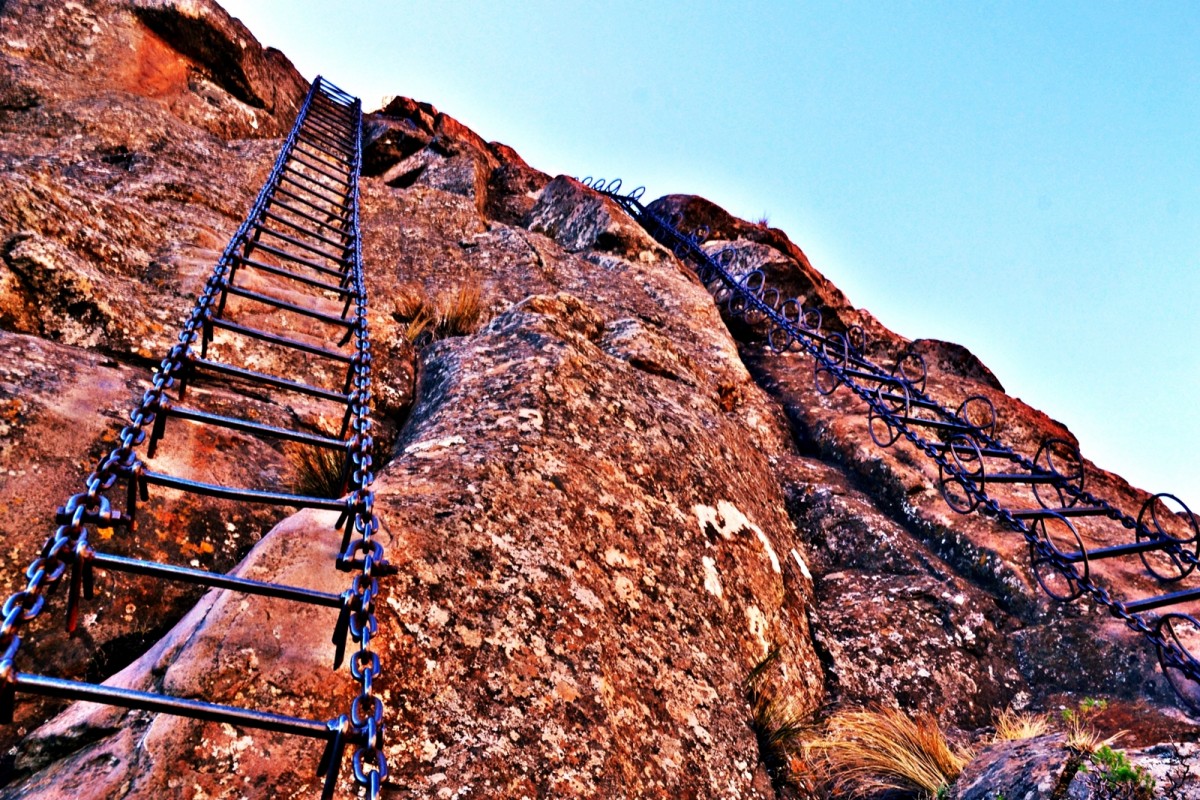
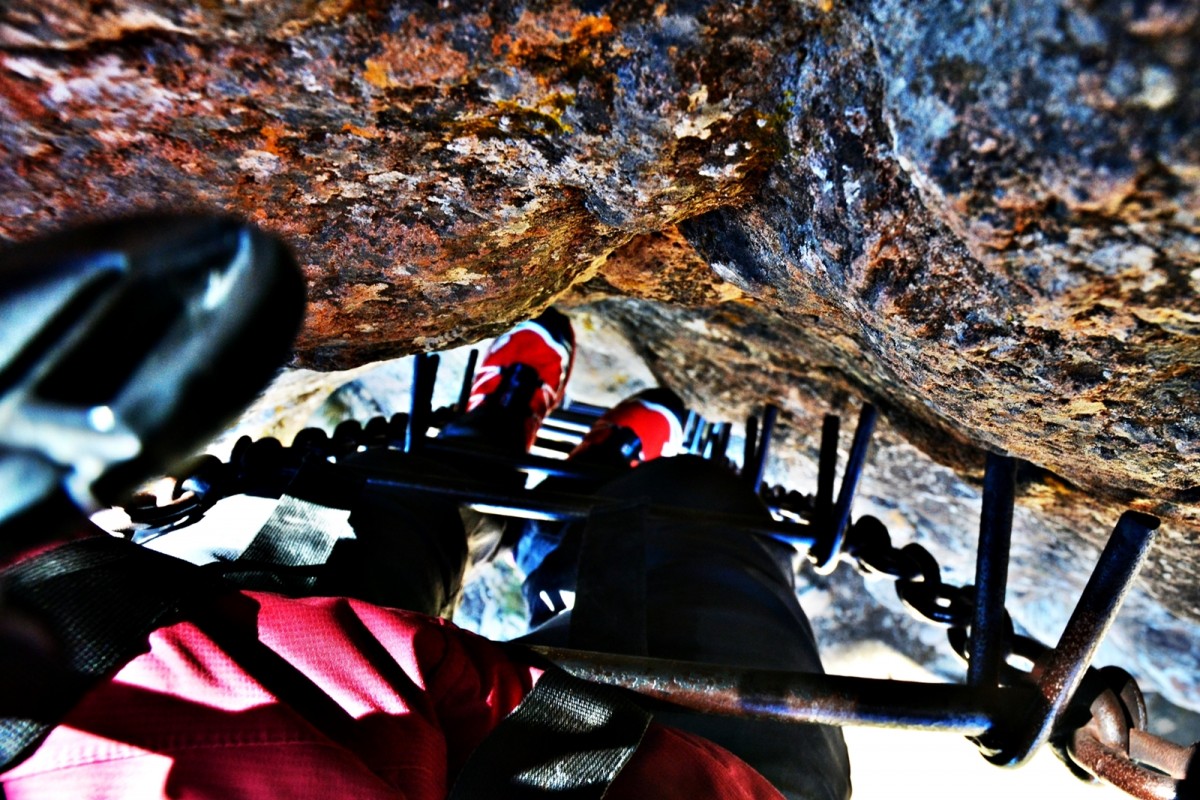
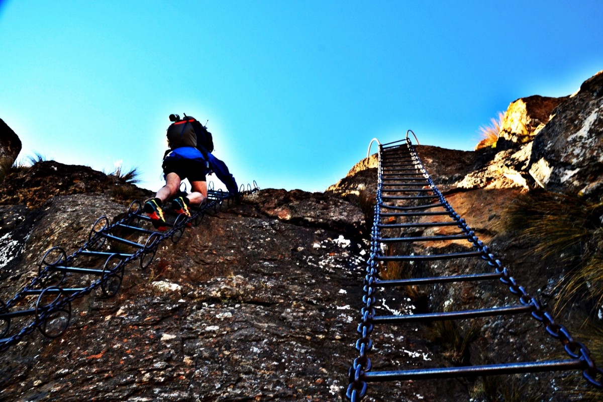
We gave our spare biltong and our car keys to the two guys on duty in the Sentinel car park hut and then set off at 05h52. Ambling along that initial, well worn and easy walking path, we saw a pair of Klipspringer and were bemused by a sign indicating ‘viewpoint’ in one direction and ‘summit’ in the other. We made some minor wrong turns and finally got to the chain-ladders where the wind was blowing noisy and hard and cold. With surprising suddenness, we were both cold and numb, certainly too numb to risk climbing the ladder with limited dexterity and the way the wind was howling past the chains, also very mindful of the added surface area for the wind to batter that were the packs on our backs. We abandoned our bags, donned goretex jackets and moved back to where a ray of sunlight was warming a section of the path and there was complete shelter from the wind. After 15 mins of waggling fingers and waving arms, the blood was flowing and we were once again warm. We returned to the ladders.
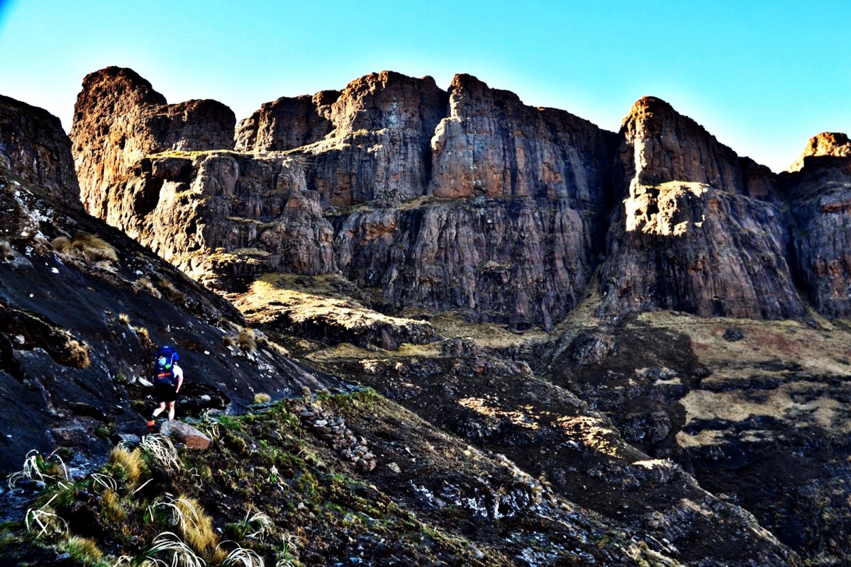
The ladders are constructed from great rings of steel linked together vertically and joined horizontally by steel ladder rungs. The weight must be enormous. The steel is rusted and has worn significant grooves into the hard rock on which it rests. Climbing the ladder is an act of faith. The rungs were sub-zero from a brief cold snap of the day before. The wind was still howling through the little gorge where the ladders snake their way to near the top of the escarpment. Within a few steps, tightly gripping to the great rings of steel, my hands were numb with cold and feeling less than fully functional. I compensated by wrapping the entire arm around the ladder for extra insurance. Meanwhile, Pall was taking photos in all directions apparently not suffering from any perception of danger.
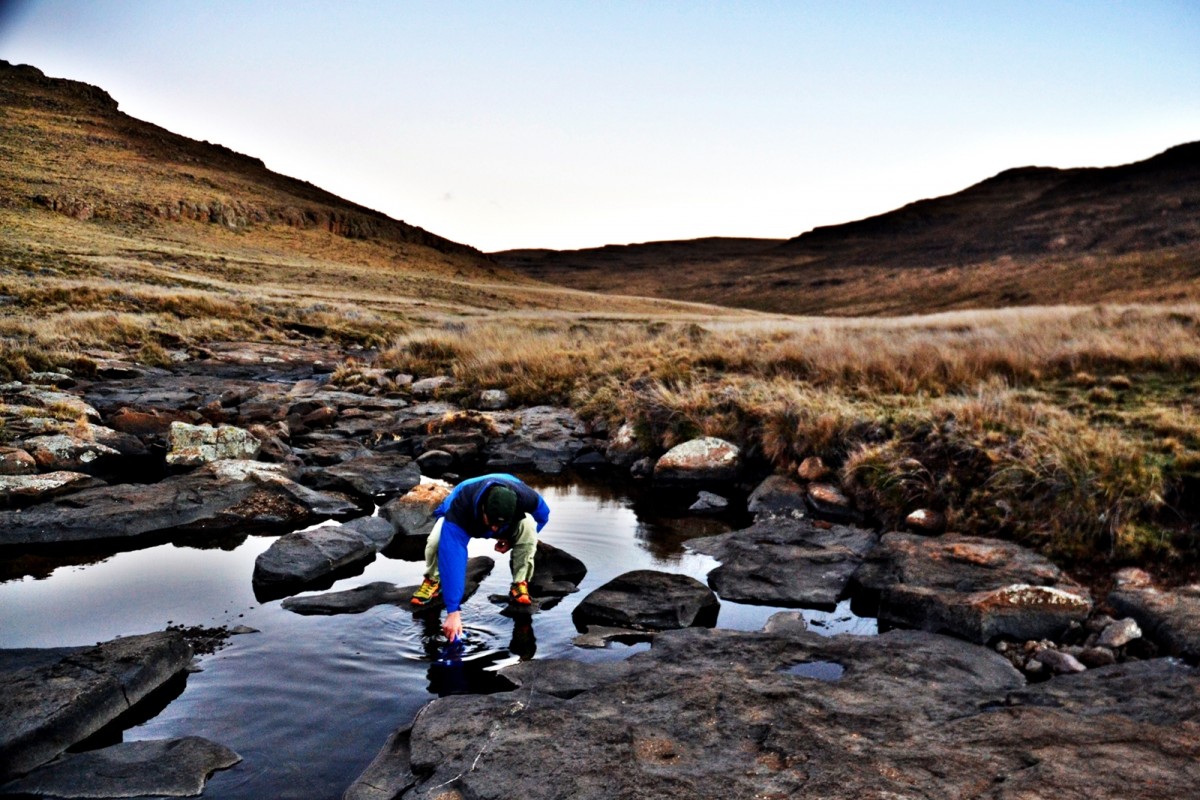
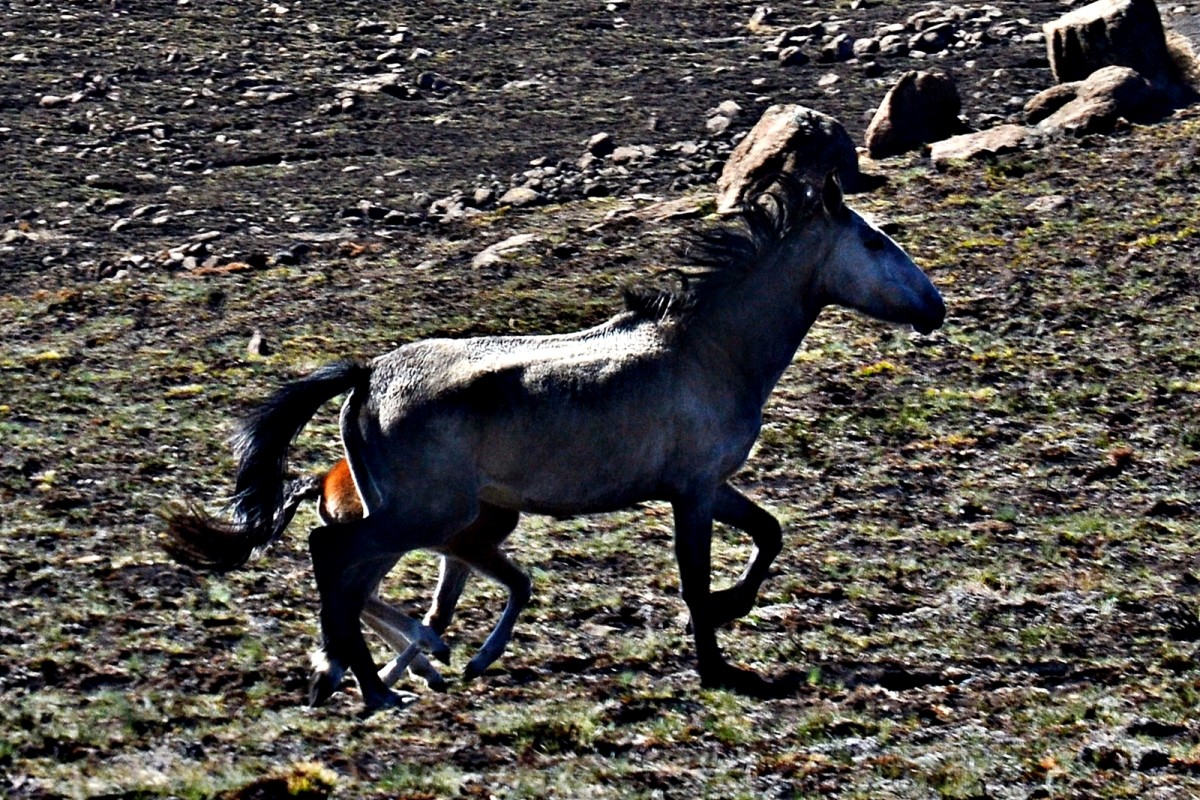
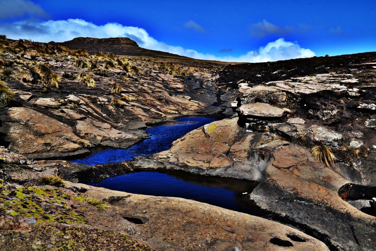
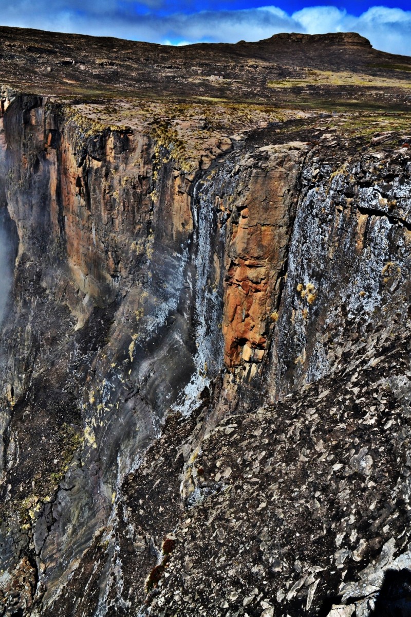
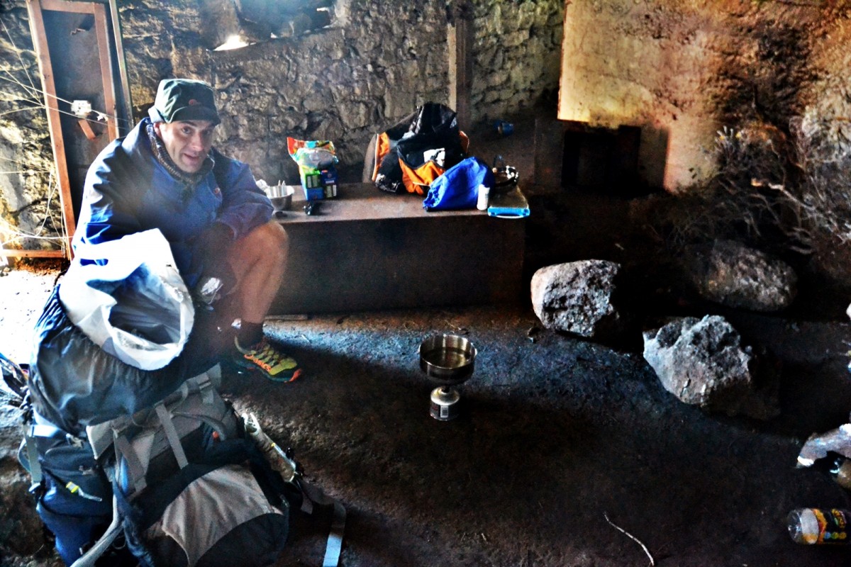
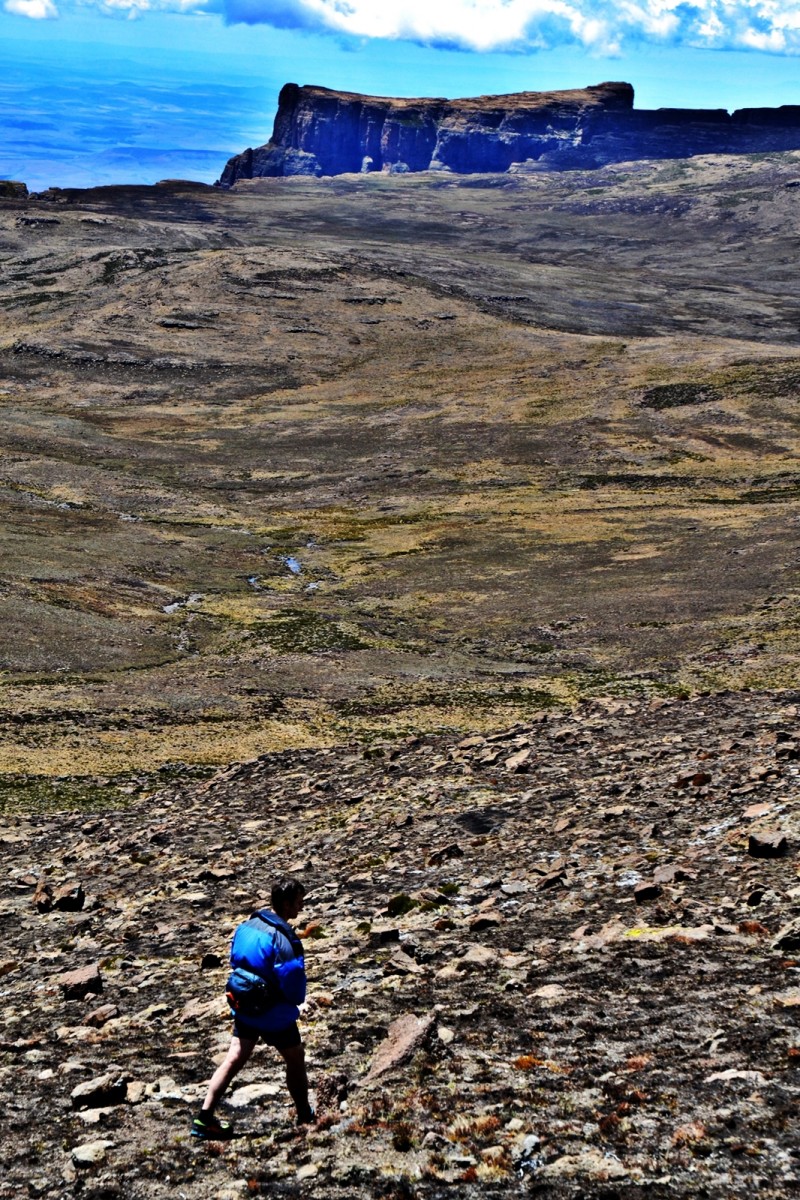
Once off the ladders, we got moving too quickly and following a series of micro-detours finally found the correct path. We decided to make a detour to Tugela Falls as they are the second highest in the world and neither of us had seen them. On the way, we disturbed a Basuto pony mare and foal. The foal ran on the far side of its mother for protection. Finally stopping, the foal raced around the front of the mare and ducked under for the comfort of the maternal milk. We reached the waterfall that was barely a trickle, and stared down off the edge into the abyss below, imagining how the plummeting water might appear during another time of year. We had breakfast in a hut which was in a dishevelled state as it had been used as a tip. It kept us out of the bitterly cold wind. At this early stage in the exercise, I noticed that I had developed a small nick in the outer part of my left shoe near the toe box.
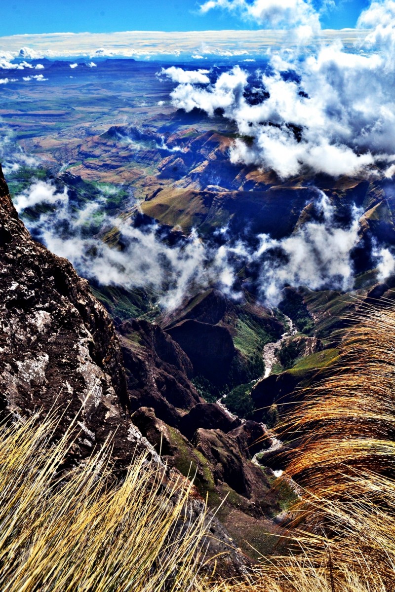
We moved off for Mont-aux-Sources, the first of the 6 checkpoints that constitute the Drakensberg Grand Traverse. I started to get cramp in my thighs whenever we went up even a small incline. This got worse until after lunch by which stage the copious amounts of salt with which I had laced my water finally reached my muscles. We left our rucksacks on the saddle of a spur running east off the peak and summited at 11h30. The spur happened to mark the border with Lesotho and as we pushed off the spur, we crossed into Lesotho turning first east until we reached the bottom of the Kubedu valley and then following it downstream to the south.
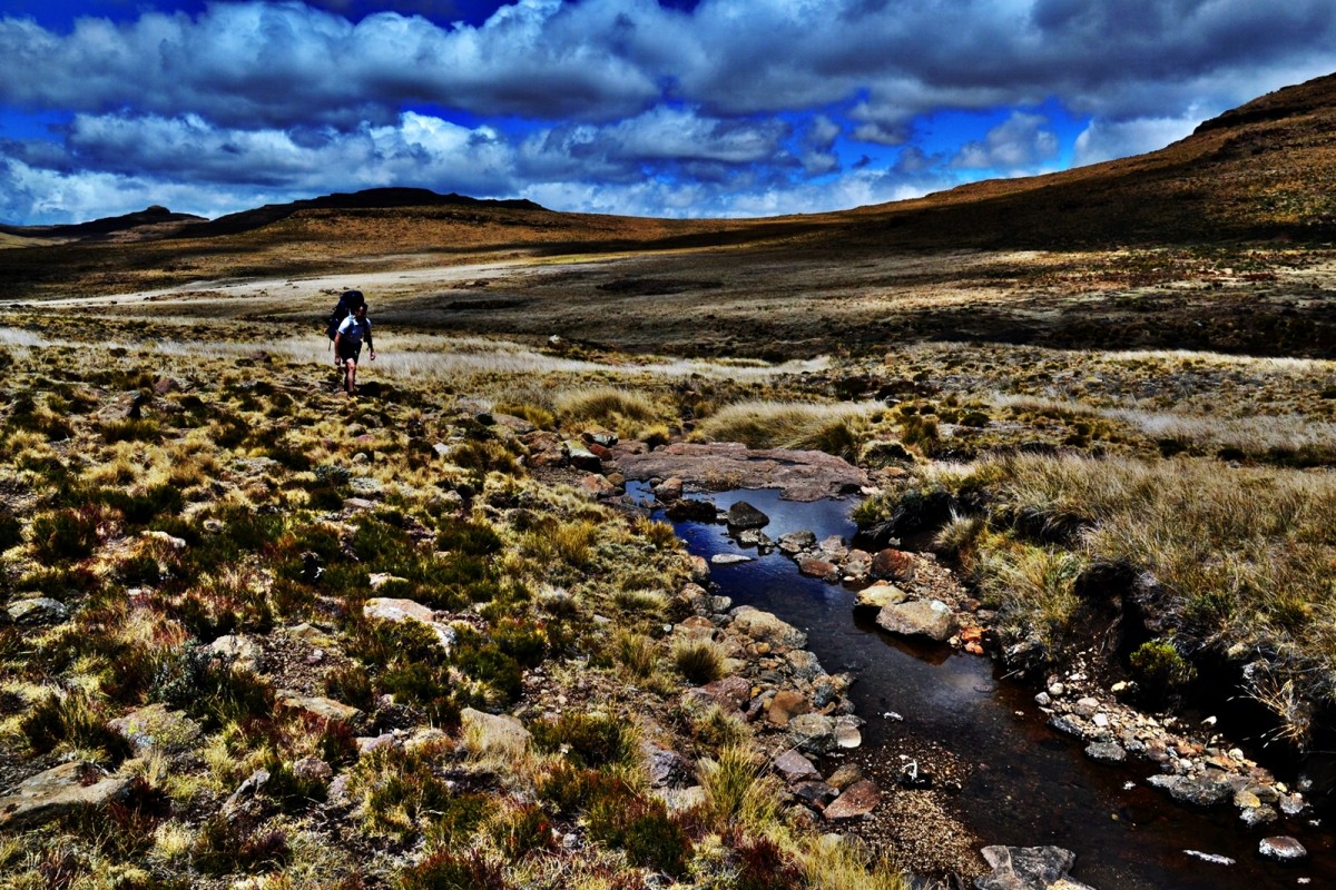
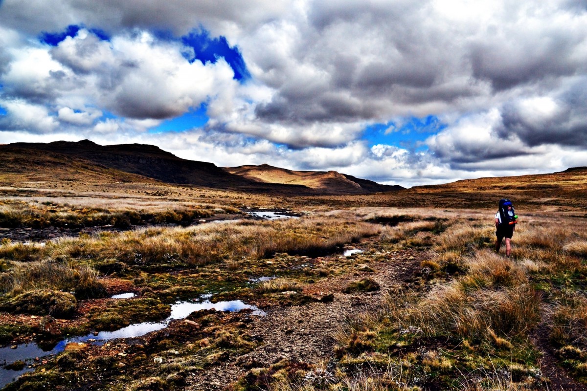
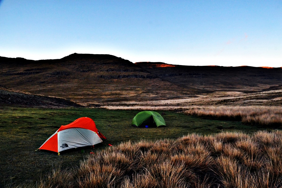
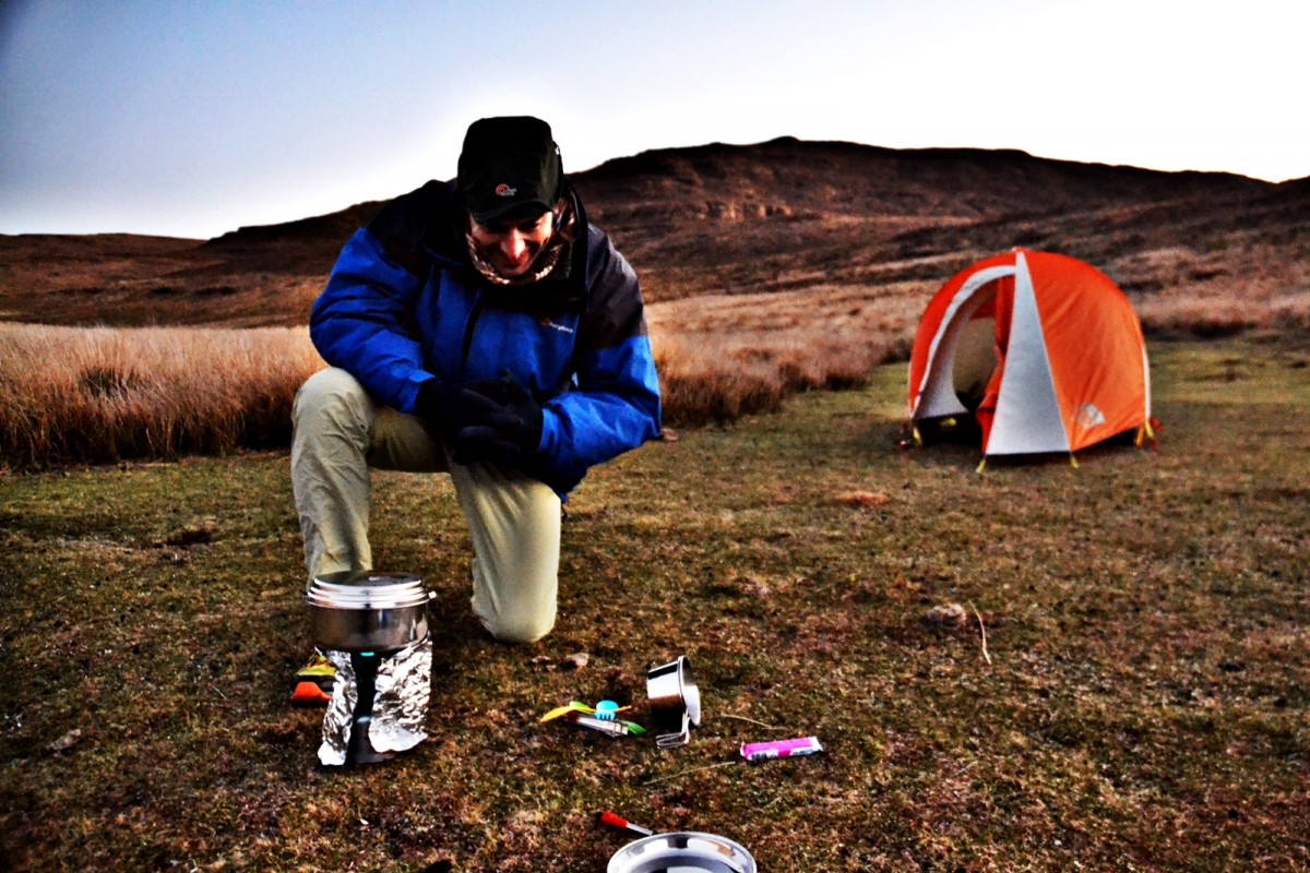
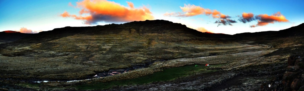
At 14h15, as it looked like it might rain, we stopped where a tributary, descending the escarpment edge to our east, joined the main stream that we had been following. We lunched on the picturesque stream bank surveying the route that we had just descended. We set off east up the valley of the tributary soon turning up the second re-entrant to the south. It was a long slog with waist straps digging into hips. We summited the saddle a little further east than intended. I took a back bearing to calculate more precisely where we were on the ridge. We made a final push around the head of a re-entrant and then painfully downhill, unaccustomed muscles and joints pleading for respite. We were rewarded with an ideal campsite of dry grass cropped comfortably short and near crystal clear water at 18h30. We had walked 24 kms total, of which only 20 were on route. Dusk was accompanied by the melancholic call of a lone jackal. Soon tents were up, dinner was eaten and were wrapped in our sleeping bags for our first night on the escarpment.